Mapping the Landscape/The Wayside Arts Trail
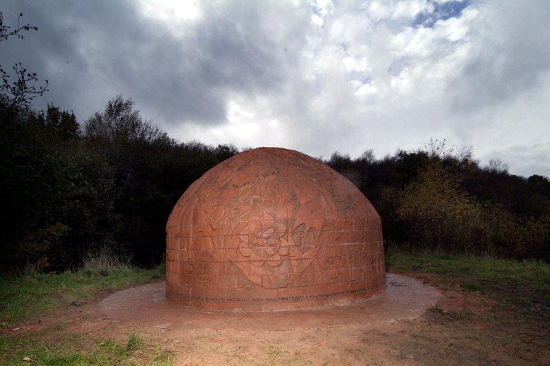
Image - 'Brick Kiln' by Julie Miles
Mapping the Landscape/The Wayside Arts Trail
Mapping the Landscape was a collaboration between Land and the Forest of Burnley to develop the section of the Burnley Way from Towneley Park up to the Panopticon site at Crown Point, creating a new family walk for the East Lancashire Regional Park.
The project developed in three stages during 2004-2005. First, sculptor Martyn Bednarczuk from Oswaldtwistle, designed and carved 12 unique fingerposts from local green oak, featuring local wildlife, and installed them at intervals along the walk with the help of students from Myerscough College in Burnley.
Blackburn artist Julie Miles then worked with children from St John’s Junior School, who carved additional waymarkers out of brick, again featuring delightful representations of local insects, birds and woodland animals. These are set into the ground at the foot of each signpost and at intervals in between. Julie also worked with children from Christ the King Primary School to create a three-metre-long ceramic map depicting the route, which is positioned near the start of the walk immediately behind Towneley Hall.
The third stage was the creation by Julie of a replica ‘beehive’ brick kiln now sited, appropriately, near the small housing estate known as The Kilns. The almost 2-metre high kiln, covered with intricate designs by schoolchildren, was installed in autumn 2005 and has become a very popular feature in the landscape.


